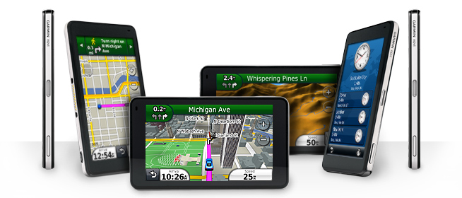
Overview
The Garmin nuvi 3790 LMT is currently the top of the line automotive
unit from Garmin. It is a full feature navigator and the LMT
denotes that included in the package is lifetime map and traffic
updates. It was originally listed for $499, but as of
February 2011, has gone down to $399. The 3700 series includes
the
3790 with cell phone bluetooth calling, along with voice activation and
the 3750, which does not include the
mapping or traffic extras for $290. Garmin is very proud of its
ultra thin size
(9mm) and glass like touchscreen, which looks as good to me as any
previous nuvi unit. The package includes the unit, a suction cup
mount, which has a built in speaker and a vehicle power cable.
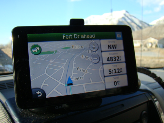
Nuvi 3790 in an optional dashboard
mount
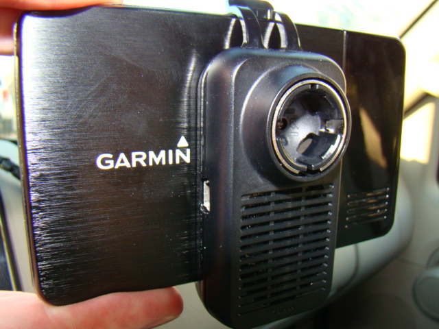
3790 in quick
release mount. Note external speaker and internal speaker on far
right.
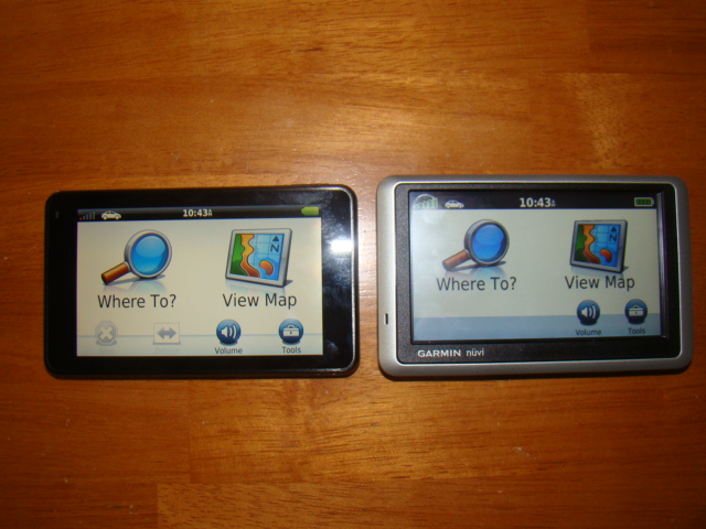
nuvi 3790 on left with nuvi 1350 model on right.
Both have the same screen size, but the 3790 is just 9 mm thick.
I bought a 3790 LMT, after my venerable StreetPilot 2820 died.
The 2820 had served me so well over the past four and a
half years, that I never choose to upgrade to a nuvi. I have used
and
tested several other nuvis during this time and when Garmin wanted $170
to repair the 2820 since it was out of warranty, I decided to go for
the latest and greatest. I have been impressed with several
features of the 3790, but disappointed in others, especially with what
I believe is a lack of options and features that have been in
other nuvi units and some now appearing in the brand new, lower cost 2X00 series. (custom avoidances, speed limit corrections, more flexibility in data fields) Overall the nuvi 3790LMT is a good
unit, but the $400 price tag may be hard to justify, when other
new Garmin nuvi units such as the 1300 and 1400 series or the new 2300 series, do almost the
same thing and can be purchased for
much less. That being said, the 3790 does have a few new
bells and whistles I will focus on.
Size
First, you can't complain about the size of the unit, especially if you
are interested in pedestrian use in a big city. It is smaller and
lighter than my Droid phone and automatically positions for vertical
use for walking or horizontal for vehicle use. The internal
speaker is fine for pedestrian use, but the quick release mount
speaker, with its built in speaker, sounds very good. There is a
microSD slot if you need additional memory, but the 7GB internal drive
has plenty of extra room, nearly 3GB available. You
can see how the 3790 was designed, by watching an interesting short Garmin produced video here.
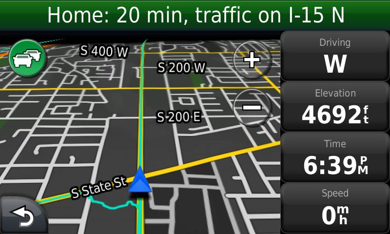
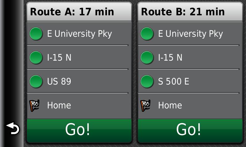
myTrends
This is a feature new to the 3700 series. According to Garmin: "With myTrends, when you save your regular destinations in your “Favorites,”
your nüvi 3790 will, over time, begin to figure out where you’re going even
without your telling it! It provides time of arrival and relevant traffic
information. So whether you’re driving to and from work or a regularly scheduled
weekly event, your nüvi 3790T will help you get there on time." From
my experience, it will predict the time of day when you go home or
to work and provide a couple of route options for you. These are
screen shots I have seen recently, which gives me the option of how I
want to go home:
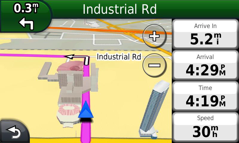
trafficTrends
This is a feature that is included with the map data. It seems to
calculate a historical speed for the road and use that in factoring the
route. I have noticed it adds about four minutes to my typical 15
minute commute. You can switch this feature off in the map
settings and it will
calculate a time I have seen in previous units. I do find it
helpful to have this factored in the route, because I know it's a good
average of when I will get there. This feature only works on
freeways and major highways as near as I can see. If you do have
this feature enabled, Garmin will anonymously upload your tracklog
data, to help in calculating these traffic trends. It will
collect the information, when you connect your unit to your myGarmin
account. You can restrict this data from being uploaded, by
adjusting settings in your myGarmin account. I noticed as I
recently updated my maps, the trafficTrends data also went from
version 3.75 to 4.00, so it appears this data is being improved.
Here's Garmin's take on trafficTrends: With trafficTrends, your nüvi 3790T automatically learns daytime trends for
traffic flow to improve your routes and better predict your estimated time of
arrival based on time of day and day of week.
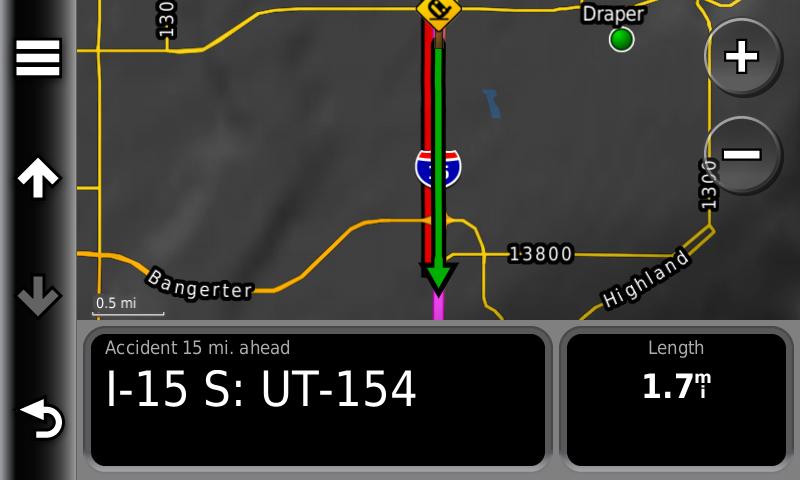
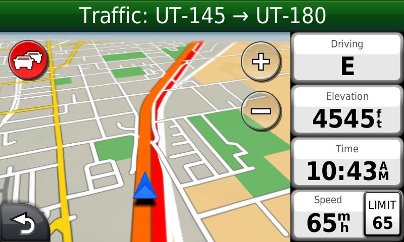
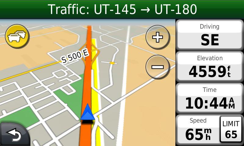
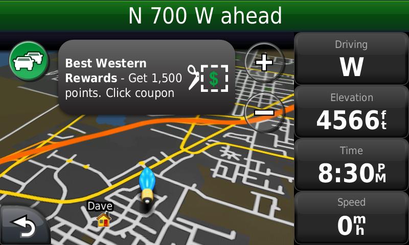
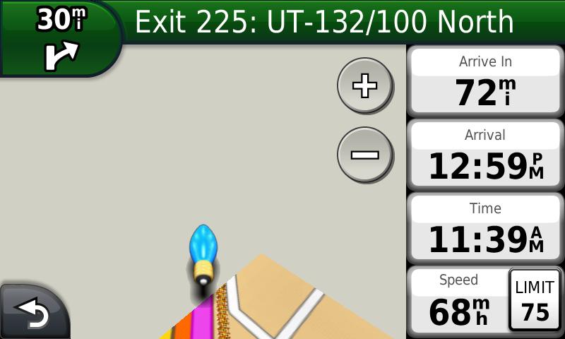
Real Time Traffic
If your 3700 is a model with a T, (i.e. 3790T) then you get free
traffic updates.
You will have to put with an occasional small popup ad.
The data
is downloaded through the included power cord, picking up signals from
FM
broadcast stations which distribute the data. The traffic
data is typically only found in metro areas. Also, unless
the unit is
connected to the cord, you won't get the data. I have found that
leaving my cable constantly powered, allows me to get the updated
traffic, as soon as I connect my 3790 by putting it into the mount.
Below are screen shots of the traffic. If you click on the
ads, you can get "special deals" with coupon codes, etc.
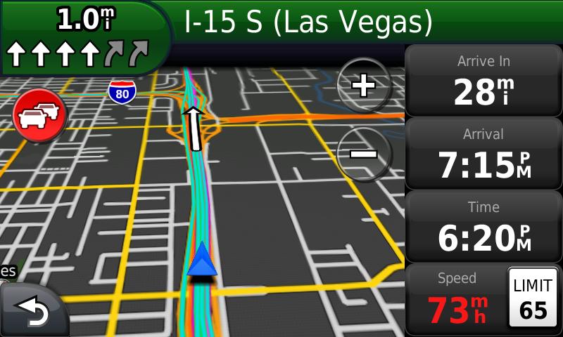
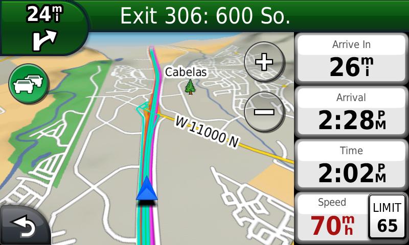
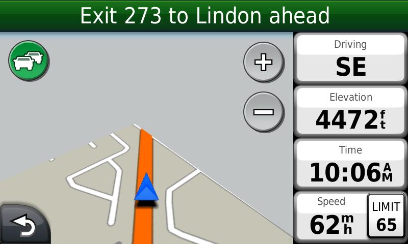
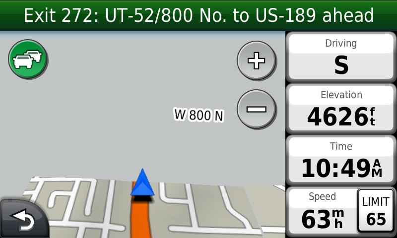
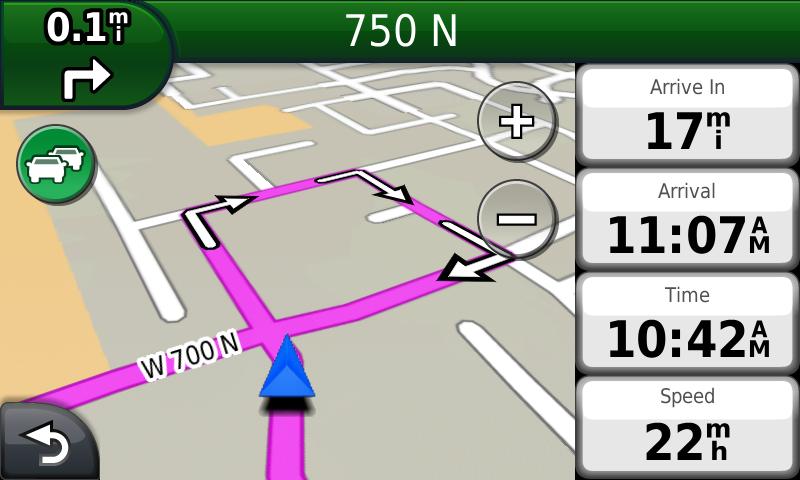
Junction View and Lane Assist
These are two very nice navigation features which have been available
in Garmin units for the past year or so. Lane assist will come up
when you are about two miles away from making an exit, or needing to
get into a new lane where there is a freeway junction. In the
upper left hand corner you will see several arrows. The ones
which
are highlighted are the ones you need to be in. I have found
these to be accurate and very helpful, especially in heavy traffic.
Lane assist is available in all areas. Junction view brings
up an image to show you what your upcoming turn looks like.
This is very nice, but not available in all areas, only high
traffic areas in major cities. But if you are in unfamiliar
territory, it will be a welcome feature to help you easily get through.
Below are screen shots.
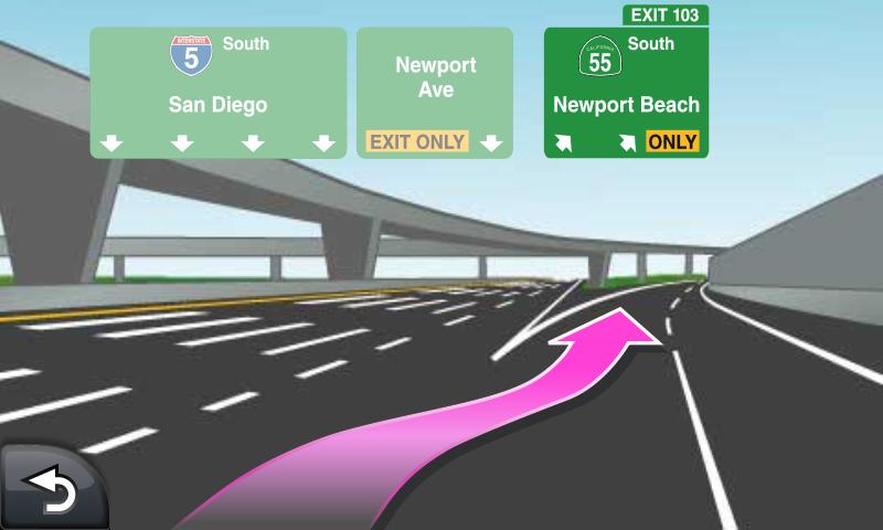
Junction View of upcoming turn and arrow showing lane to
take
This image shows I need to stay
in the four left lanes to stay on track.
The aqua lines are my trip log.
The red circle indicates traffic delays ahead
Lifetime Maps
The 3790 LMT comes with preloaded street maps of the USA, Canada AND Mexico.
If you bought the 3790 LMT, it means you get lifetime map updates,
which are suppose to be released every 3-4 months. Don't be
confused, this isn't for your lifetime or using a Garmin GPS,
it is the life of the specific unit. If you didn't get the LMT
version, you can buy a lifetime map update license for
$90. These lifetime map updates
however, have come down to what I now consider a reasonable price,
after paying more than $100 for just one update in the past. However, you are entitled to one free update, as long as you download the update with 60 days of first use. Connect
your unit to your computer and register it at garmin.com to be
taken through the map update process. It is very easy now to do.
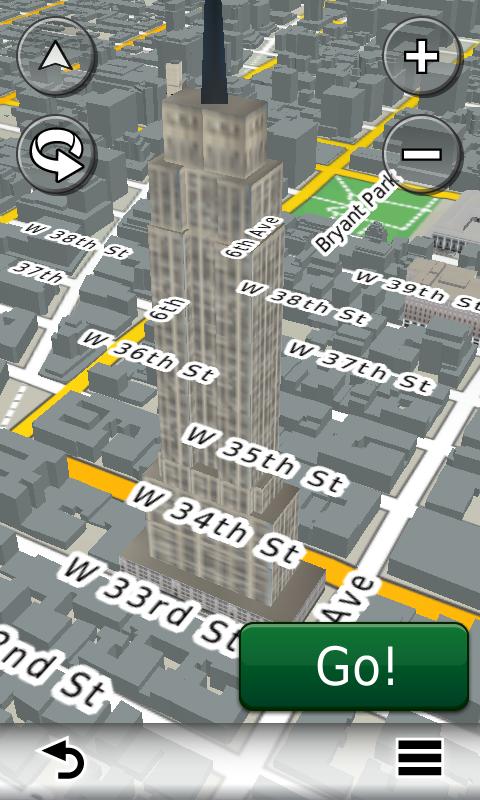
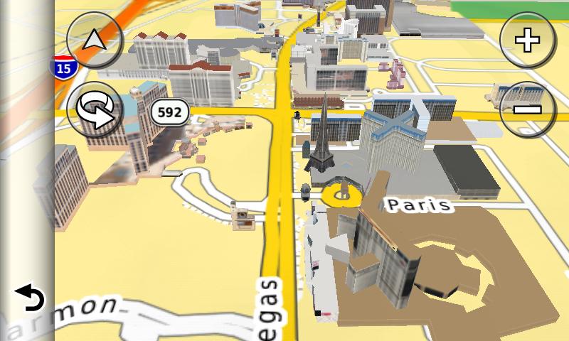
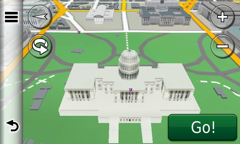
3-D Buildings
The 3700 series adds 3-D buildings to the map view. These are
mostly realistic and look nice. They don't exactly help you get
to your destination any better, but it helps to add some reality to
your drive in a big city. They are only available in metro areas
and usually only prominent buildings or landmarks are shown. In
New York City, it does show buildings in gray, but only the familiar
ones are in detail. Below are some examples from NYC, Las Vegas and
Washington D.C.
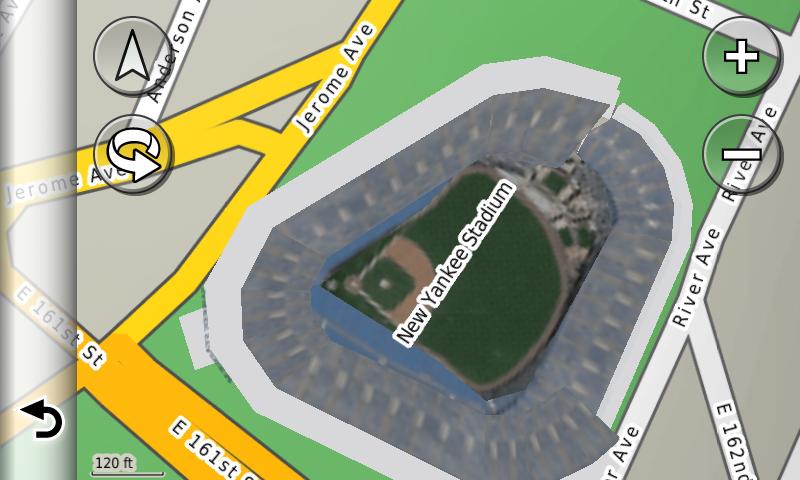
The 3-D maps also seems to incorporate a real aerial view in many
sports stadiums and baseball parks. See below of Yankee Stadium.
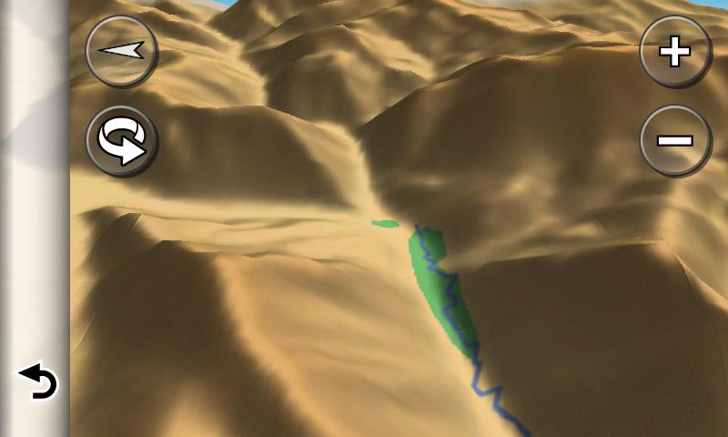
DEM Terrain
The 3-D terrain imaging is very good. If you are driving in
mountains,
you will get an appearance of the terrain. We can all hope this
will find its way into Garmin's next generation of outdoor units, as
the current 3-D view in the Oregon series isn't very good. I also
loaded in Garmin's 24K TOPO maps and they look really good on the 3790.
You can disable the DEM terrain if you choose to, in the map
settings. Here
are some examples below of the DEM terrain.
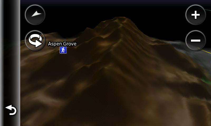
Shows mountain terrain and golf course in the bottom of
canyon
From night view. Shows waypoint along a
major mountain range
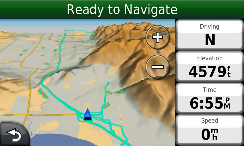
A wide view of the terrain. Aqua lines represent my trip log
Pedestrian Use
Out of all of the Garmin nuvi units, the 3790 is the best to use while
walking in a big city. The size is a plus, along with the fact it
will automatically switch between on a portrait or landscape view,
depending on how you hold the unit. The pedestrian mode can
easily be switched in the upper left hand corner of the Where To page.
Switching to pedestrian will keep it from routing you on
freeways, highways, etc. You can then get a route, distance,
time, etc. Overall it is a very nice feature for getting around
in an unfamiliar city on foot. You have to
purchase the City Xplorer maps if you want help using subways, public transit, etc. Each city
runs you about $10. But if you are walking to your destination,
the preloaded maps will help you get around just fine. Examples below.
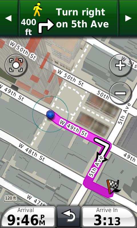
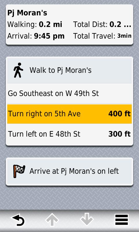
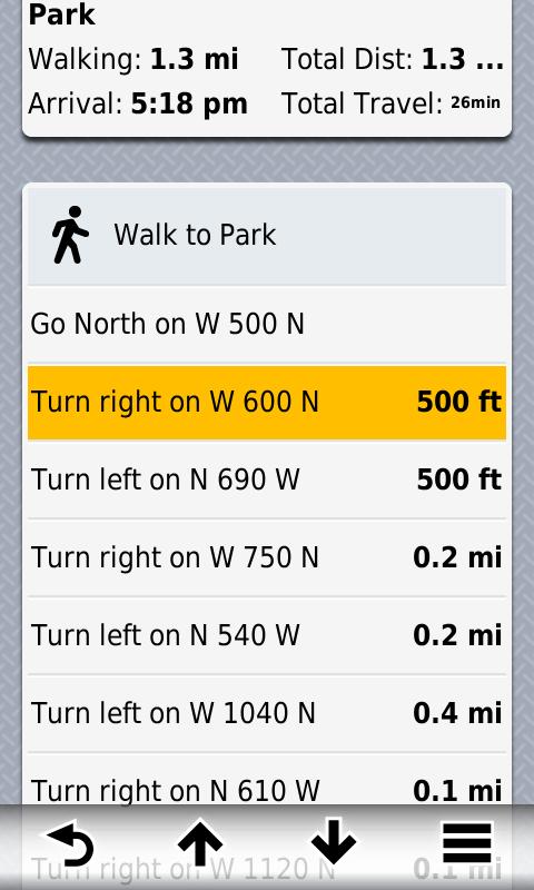
Example of a walk to a restaurant in NYC. Map page shows 3-D buildings, while route page shows you directions.
The main page adjusts to a vertical screen, which is helpful in
pedestrian mode. Also note icon on the top left, shows a man,
instead of a car in pedestrian mode, which will route you on streets and not on highways, freeways, etc.
Speed Limits
Garmin has posted speed limits on the map page in some of its
latest units. You now get a red indicator, if your current speed
exceeds the posted limit. While for the most part these limits
are accurate, be advised some are wrong and so it is best to verify
with the actual speed limit signs posted, as you travel.
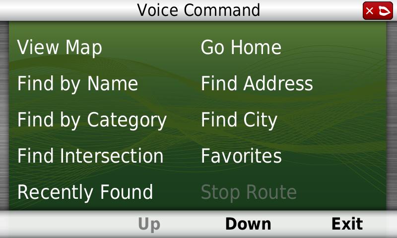
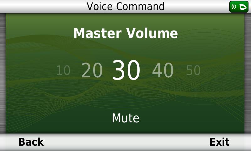
Voice Command
The 3790 has the ability to take voice commands from the user.
Overall this is a nice feature and works well for me most of the
time. I usually limit myself to inputting an address vocally, but
when you are driving it is helpful. I sometimes feel like I have
to yell or raise my voice at it, to get it to work. You can also
adjust the volume, in addition to the searching options shown below.
You can customize a "wake up phrase" so the unit will ask you for
a command. The one limitation is that for waypoints in your
favorites category, you can only select from the nearest, and it gives
you four waypoints on a page at a time. It would be very nice if
you could speak the name of the favorite. I don't use Voice Command
everyday, but it is handy for me to input an address using the voice feature.
Touchscreen
The Touchscreen on the 3790 works very well and is very bright.
It has a shiny, glass look, however it really attracts
fingerprints. The
good news is that when the unit is on, you can't see those
fingerprints. The 3790 has what Garmin calls a multi touch
interface. You can
easily zoom in, out, etc, by using two fingers. Garmin has
produced a good demonstration of these features, which you can
watch on You Tube by clicking here. Overall, the resolution on the touchscreen looks beautiful.
World Clock
You can customize the world clock to find the time in three major
cities around the world, in addition to your current location which is
automatically shown. There is also a nice map of the world and
you can see where the sun is shining and where it is dark at the moment.
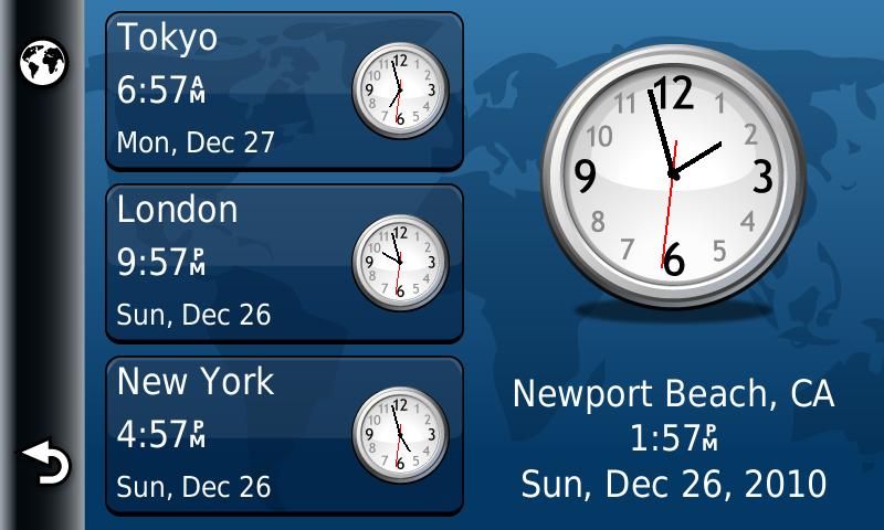
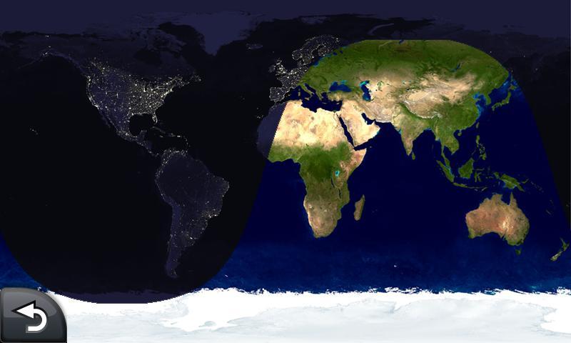
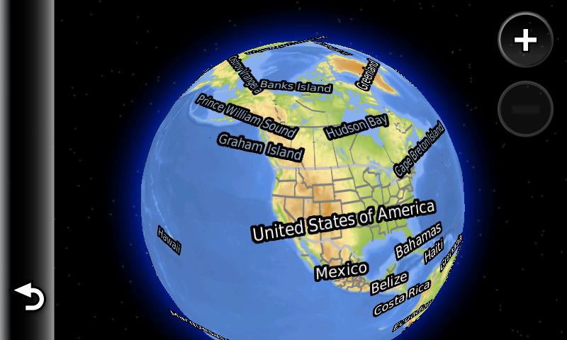
You can also zoom out the map, and turn around the globe, and then zoom
back into anywhere in the world. There is a pretty decent basemap
of the world also preloaded on the unit.
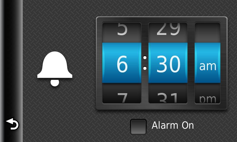
Alarm Clock
There is a built in alarm in the unit, which is easy to set and the
unit will wake up from standby mode, to sound the alarm. A nice
feature for when you are traveling.
Help
I have seen the help option in the last few Garmin nuvi's, 13xx and
14xx series as well as the 37xx. Garmin deserves some praise for
this. You can access many answers to common questions you may
have about the unit. It is just as good as a paper manual and is
actually quite helpful, not only to learn about your unit, but anytime
you have a question. The help section includes several
categories and sub categories. There is also the last position
feature, which in this unit is found in the "parking" category.
It will lead you back to your car in the parking lot, if you
navigate to it.
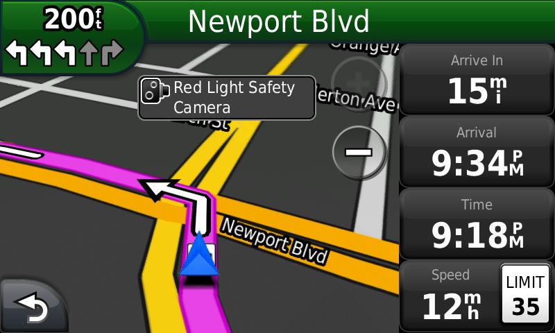
Red Light Safety Cameras
The 3790 does have some red light safety camera warnings built in.
Typically in the past you have had to subscribe and add these
yourself as Custom POI's. It's unclear how complete this database
is, but I can verify the red light camera shown below, does actually
exist, as I have seen it in person.
Glitches, Bugs, etc.
The biggest problem and complaint for me, is that the unit at times
cannot redraw the map, as you are driving. I have tried to decide
if this involves the traffic, extensive use without a power
cycle or the 3-D terrain maps. I can't find any of them are
involved through experimenting, but several times I have experienced
the unit unable to keep
up with redrawing the map as I am driving. I have also
experienced the map page blinking. As of the latest Garmin
firmware update, version 3.90,
Garmin says it has improved map drawing.
It appears the problem has been fixed, and it is another reason
to make sure you have the latest firmware. Here are three screen
shots demonstrating the problem of the map screen running on firmware
version 3.60.
Other than the map drawing problem, I haven't had any other real issues. I
have only
had the unit freeze up on me once. Holding down the power button
for 10-15 seconds restarted it.
Minor Routing Issues
The 3790 does have a problem at getting you off to a good start at
times.
Frequently, you will be calculated a bizarre route as you
begin navigation, especially if you are moving at the time. In
the case shown below, you can simply turn left and continue on as
you should. I still can't tell if
this is an issue with U-Turns in the Avoidances section of the menu or
not,
but it's annoying. I have NOT seen any other routing issues in
more
than 3600 miles driven with the 3790.
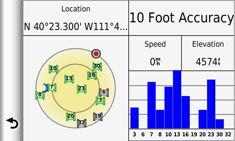
Satellite Page
A Satellite Page is available in the 3790. You can access
it by holding the signal strength meter in the upper left hand
corner of the main menu, but it takes some effort. In horizontal
view mode, the
Lat/Long does not display properly. (see longitude reading
below) You can hold it vertically to
get it right however.
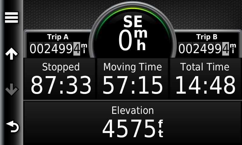
Trip Computer
The Trip Computer's look has been updated in the 3790. There are
two separate trip odometers. It also has a second page of data
available. You cannot customize any of this data however, which is a disappointment.
Bluetooth
The 3790 does have a bluetooth cell phone interface, for hands free calling. The unit
easily paired with my HTC Droid phone and allows you to place calls and
operates as a hands free system, while you are driving. I have
tested it and found no problems. You can dial, store contacts,
accept and end calls through the nuvi. Personally I prefer to
just use my phone, as it seems more complicated/hazardous for me to run
my phone through my GPS, and some have said it is harder to hear me on
the other end. Individual users may disagree and find this to be
a helpful feature.
Pros
Small and lightweight and easy to use while walking
Offers both a portrait and landscape view, which switches automatically, depending on how you hold it.
Good battery life, especially with standby mode
Quick and easy release from vehicle mount. Few nuvi models
have this feature, which doesn't require a physical USB connection
Voice Command option is much improved from the 800 series and overall I am happy with it, especially speaking in an address
Built in speaker in the included mount, sounds very good.
Cons
Intermittent issues with redrawing of map (appears to be corrected as of 3.90 software update)
Power button can be unresponsive at times to shutdown (requires you to hold it for several seconds)
No preloaded POI's visible on map. You can only find, restaurants, stores, etc. by searching the POI menu.
Custom POI's icons not shown, only the gray dot. For also long as
this feature has been in other Garmin units, this seems to be a major
oversight.
Custom POI's are not shown with their custom symbol, just the small gray dot with a pink outline.
Cannot turn off the beep when you touch the screen
Waypoints don't always show up on map-- inconsistencies with what is shown, depending on map scale
Cannot pan the map and then select a location to navigate to without
going to "browse map" Then you have select a street, can't
navigate to empty space on map.
Some features have been scaled back, (customize data fields)-- in
apparent attempt by Garmin to simplify use for the average consumer
Satellite page is difficult to access-- pressing signal strength
meter in upper left hand corner can take time to activate and is
inconsistent
Cannot load your own geotagged photos-- (even those tagged with the
Garmin 550) can only add photos from using Garmin Connect Photos (all
nuvis affected by this)
Garmin has cut out features such as MP3 player, audio jack, etc.
I liked having it built into my GPS. Now I have to have a
separate MP3 for music.
I miss having XM radio built into my 2820. I realize the
partnership between the companies didn't last, but I would have liked
to have XM/Sirius in my nuvi
Is not compatible with some of Garmin's extra programs, such as MAD MAPS.
Carrying case is not included in package, but can be purchased for $20. It does help to protect your unit from scratches.
Summary
If you want Garmin's top of the line nuvi, then the 3790 is the unit
for you. But if you want a good GPS navigator to get you where
you are headed, then the Garmin 1390 or five inch screen 1490 may be what you want, and
you will
save a lot of money. The recently released 2X00
series
is also an option, which has many of the same new features, (myTrends, trafficTrends) in a scaled
back
unit and price. As Garmin has done in the past, software updates
typically get a brand new unit is running well within a few
months. As of this writing,
there are still a few minor fixes needed.
You can look at the improvements made, by visiting the firmware update page here. I would also like to see more user flexibility in this high
priced unit. To
see the official product page click here. Here is a direct link to the online owner's manual.
Questions/Comments: Visit the gpsinformation.net Forum
Return
to:gpsinformation.net